Maryland data network aims to save lives, property with earlier weather warnings
By Kristi King
Because extreme weather events are becoming more common, Maryland is in the process of building a network of data collection towers to improve forecasts overall and provide early warnings about severe weather.
The Maryland Mesonet (mesoscale network) of automated weather-observing equipment will provide real-time information transferred wirelessly to a central server, which will be shared through a website with visualizations, maps, charts and archives.
There are nearly two dozen Mesonet projects in the Midwest in so-called “Tornado Alley” states, such as Oklahoma.
The Maryland Mesonet project involves a partnership between the University of Maryland and Maryland’s Department of Emergency Management. It includes local partners, private sector partners and the federal government.
Gov. Larry Hogan (R) said the state has committed $4 million to the project, “which will give our emergency managers even faster and more accurate satellite data to make critical decisions about preparedness and deploying resources,” he said at the announcement on the College Park campus Monday.
Maryland Department of Emergency Management Secretary Russ J. Strickland said the information shared with the National Weather Service will save lives.
“And it’s personal to me, because I was here for the tornado in 2001,” Strickland said, recalling being part of the University of Maryland community since turning 18. “I will never forget that day. This is an opportunity for us to make sure this never happens again; it gives that split-second additional warning that will make a difference for lives in the future.”
The statewide system should be up and running with 12 towers by the end of summer 2023 and will include 78 tower locations by early 2024.
“Right now, we’re doing the modeling analysis as to where tower placements could be most insightful or impactful for the weather forecasts,” said Sumant Nigam, professor and chair of the Department of Atmospheric & Oceanic Science and a professor in the Earth System Science Interdisciplinary Center at the University of Maryland.
The towers will have equipment to take readings, for example, of air temperature, air pressure and humidity, along with soil conditions.
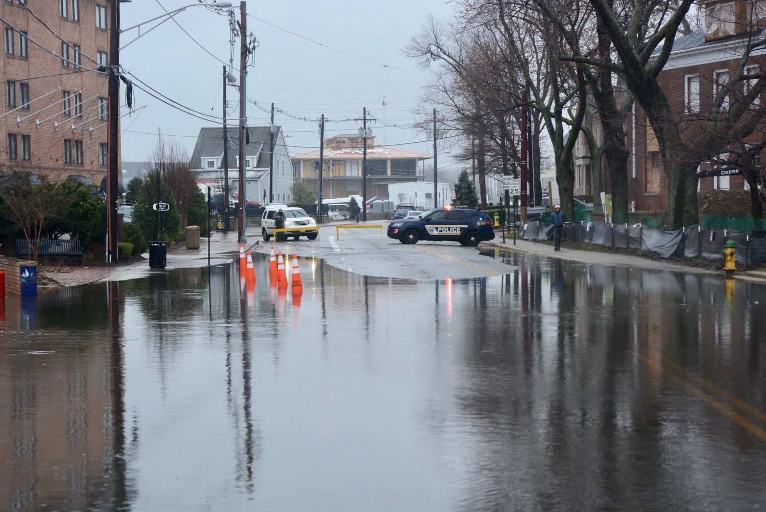
Real-time soil moisture and soil temperature analysis down to 1 meter could help give people in flood-prone areas early warning during heavy rains.
“The emergency management offices will issue a flood warning much more quickly than they would otherwise because they know that the soil has no more capacity to absorb the rainfall and it will all run off and cause flooding,” he said.
Depending on the type of weather emergency, the Mesonet could provide minutes or seconds of advance notice, Nigam said.
“The biggest impact will be that this high-resolution data will go into the National Weather Service … so the regional forecast is going to get better, because there is more data and better-quality data going into the making of the forecast,” Nigam said.
The Maryland Mesonet will also share data with Delaware and Pennsylvania.
As part of Maryland Matters’ content sharing agreement with WTOP, we feature this article from Kristi King. Click here for the WTOP News website.
Maryland Matters is a proud partner with WTOP News, which delivers the latest local news, traffic and weather information to the Washington, D.C., region. Click here for the WTOP News website.
Related Articles

In the first TV ad of his congressional campaign, Del. Mark S. Chang (D-Anne Arundel) does a plausible imitation of James Bond,

Alsobrooks’ spot looks a little like the ‘Sgt. Pepper’s Lonely Hearts Club Band’ album cover, with tailored versions for the Baltimore and D.C. media markets.
The leading Democratic candidates for U.S. Senate tout experience, statewide support and electability in the Fox45 studios in Baltimore.
 Creative Commons Attribution